Travel-Maine.Info
|
Main Menu
Home
Blog
FALL
Fall Foliage
Apple Orchards
Halloween
Hunting
Thanksgiving
WINTER
Alpine Skiing
Nordic Skiing
Snowmobiling
Ice Fishing
Dogsledding
Snowshoeing
SPRING
Maple Syrup
SUMMER
Biking
Birding
Seacoast
Whitewater Rafting
Kayaking
Camping
Hiking
Fishing
Summer Camps
Windjammers
THINGS TO DO
Vacation Planner
Shopping
Places to Visit
Recreation
Forts
Lighthouses
Museums
HELPFUL PAGES
Cities & Towns
Maine Blogs
Maps
Maine News Media
Books about Maine
Business Directory
Business Services
Real Estate
Great Sebascodegan Island, Maine
Home > Seacoast > Great Sebascodegan Island
This island is located on the coast of Maine about 7 miles south of Brunswick, Maine heading south on Route 24. It is part of the Town of Harpswell, Maine. The island is almost 5 miles long and 5 miles wide. It is located about 43 miles from Portland, Maine. It is north of Orr's Island and south of Brunswick.
History of Great Sebascodegan Island
See http://community.curtislibrary.com/hhs/history/townhist.htm.
Places to See
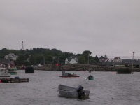
Cribstone Bridge. This unique bridge was built in the 1920's and joined Orr's Island and Bailey Island - spanning Will's Gut. It was made of granite stone slabs quarried in Yarmouth and Pownal, Maine. It is the only bridge like it in the world and is now a historical site. A newer bridge has since replaced it. (see the picture at right).
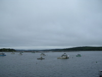
Cundy's Harbor. A working fishermen's harbor. Has a souvenir shop, general store, and restaurant selling sandwiches and fish dinners.
Things to Do
Casco Bay Lines Nature Cruise. Takes place at noon-time. Runs from end of July to Labor Day. Catch the ride on the northern tip of Bailey Island near the public boat ramp and Cooks Lobster House.
Art Galleries and Studios in Harpswell and on Harpswell Islands
by the Harpswell Business Association
http://www.harpswellmaine.org/studios.html
List of Things to Do - By Bowdoin College, Brunswick, Maine
Community Events Calendar by the Harpswell Anchor
How to Get to Great Sebascodegan Island
From I-295 take the Topsham exit. Continue on to Route 1. Take the first exit at Cooks Corner. Take Route 24 South. It is about 12 miles south of Brunswick / Topsham area.
Maps of Great Sebascodegan Island
Map of Harpswell Including Great Sabascodegan Island
by the Harpswell Business Association
http://www.harpswellmaine.org/hba_imagemap.html
Map of Harpswell, Maine by Harpswell Festival
http://www.harpswellfestival.org/directions/directions.htm
Casco Bay Chart by BoatMaine.US
http://www.boatmaine.us/casco-chart-large.aspx
Harpswell Heritage Land Trust
Map of conserved land In Harpswell, Maine
Map of Midcoast Maine by MaineGuide.com
Websites with Info on Great Sebascodegan Island
Harpswell, Maine Business Association
http://www.harpswellmaine.org/index.html
Town of Harpswell's Official Website
http://www.harpswell.maine.gov
Harpswell Heritage Land Trust
www.harpswelllandtrust.org
Places to Eat - Dining
Holbrooks Snack Bar & Grille
984 Cundy's Harbor Road, Harpswell, Maine
(207) 725-9050
Middlebay Lobster Store
Ellen Way, Cundy's Harbor, Harpswell, Maine
(207) 798-5868
|
|
AdsThe website is an Amazon Associate and earns money for qualifying purchases.
|
|
|